I do like to walk beside the sea, so thought for one of our days away, we should try walking the South West Coast Path from Bridport, or rather West Bay, towards Lyme Regis. The route from West Bay is hilly to put it mildly, no sooner have you gone up and then down and the business starts all over again. With Golden Cap, the highest point on the South Coast at 191m, looming ahead we decided to walk inland rather than back tracking the way we had come, making a circular walk. This wasn't all that easy to do, getting to Chideok the footpath was easy to follow, although crossing the main road was hard. After that, we were aiming for Hell Lane, but got lost for a while in fields where signs petered out. Hell Lane is a magnificent subterranean walkway between fields, despite its name, it's a lovely walk, and just before Quarry Cross, you get a fabulous view of the iconic Colmer's Hill seen from many vantage points in the area.
I took quite a few photos of
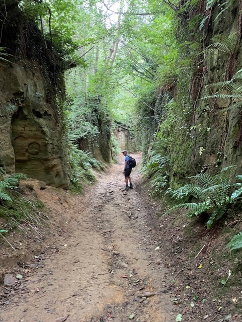
Hell Lane as well, from the name I wondered whether it was very muddy, or unpleasant in some way, but it certainly isn't. There are lots of references to it, it seems we found a great walking route simply by wandering around and trying to get off the steep coast path
Looking at Tim in the distance gives you an idea of how far the lane is below surrounding fields
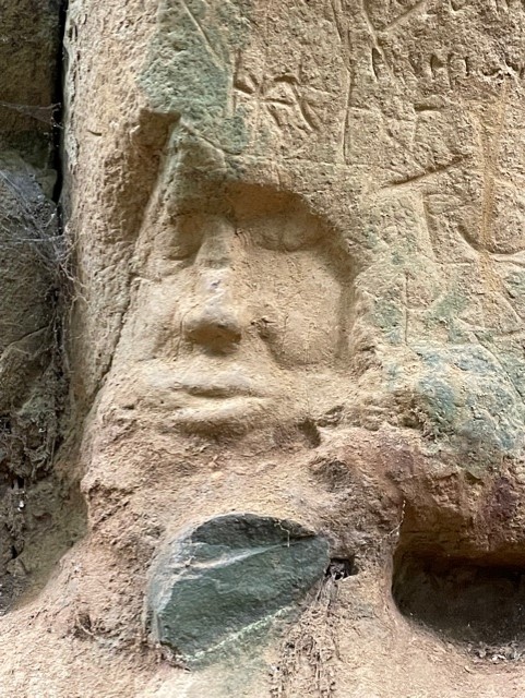
We also came across some amazing rock carvings in the sides
and this one
It's a bit narrower here
and here's another face. We walked to Symondsbury, with Colmer's Hill very much in evidence, and then walked Monarch's Way from Bridport to West Bay, nearly missing the route to the river from Bridport High St which wasn't signposted, but by looking at the map, I saw it was by a church.
In Bridport the next day, I realised that Colmer's Hill can also be seen from there.
I'm hoping we can visit the area again, the network of footpaths is fantastic and there's so much to see.


Comments
Post a Comment